
Introduction
Urban Planning
In the post-pandemic reality, a vision for urbanism is necessarily situated in the critical issues of our time: climate change, social and racial justice, and emerging technologies. While their scale is global, students in the Urban Planning Program connect these issues with the local and regional contexts through grounded analysis of socioeconomic and political conditions. Our program prepares students to confront and break down structures and practices of oppression rooted in inequality, racism, and sexism. It also fosters creative and critical approaches to planning and policy that improve processes and outcomes in cities around the world. The work completed this academic year shows how Urban Planning students embrace professional challenges and responsibilities with sensitivity and courage.
Studios
Spring 2023
Indigenous Roots: Planning for a Cultural Movement
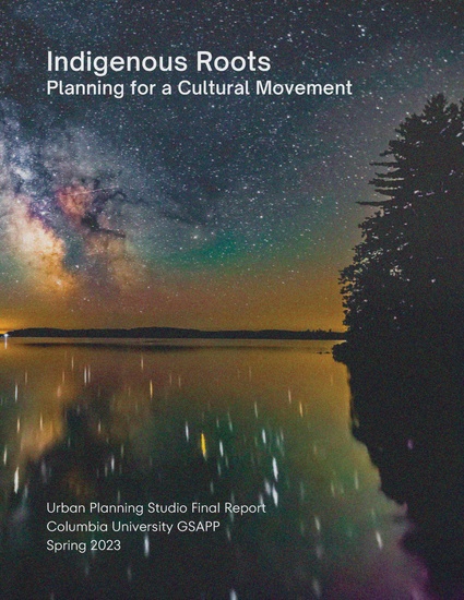
This studio collaborated with Sandra Laronde, Founder and Creative Director of Red Sky Performance. Red Sky Performance is a leading company of contemporary Indigenous performance in Kanata (Canada) and worldwide.
The purpose of the studio is twofold:
- To propose a strategic plan for the development of Red Sky Performance sites in Tkaronto (Toronto) and Teme-Augama (Temagami), Kanata.
- To deconstruct Western planning paradigms to center Indigenous ways of knowing
The studio uses Indigenous place names throughout this report in honor of the legacy they hold.
The studio reviewed and synthesized scholarship on decolonizing planning, Anishinaabe histories, land back movements, and the Indigenous planning process in concert with our site proposals. At the core of the project lies a complex dynamic between Western planning paradigms and Indigenous ways of knowing. Western planning has a tendency to prioritize individual property rights and economic incentives over communal ownership and land stewardship. More concisely, we ask whether urban planning can meaningfully contribute to Indigenous ways of life. The studio reflects the position that Indigenous Nations must not only be consulted with but included at all stages of the planning process.
Spring 2023
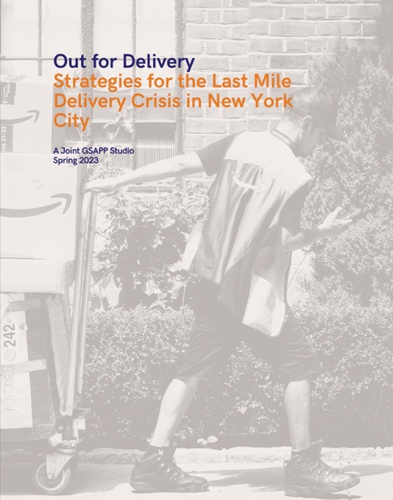
Out for Delivery
Graduate students from the M.S. Urban Planning, M.S. Real Estate Development, M.S. Urban Design and New York/Paris Program have worked in an interdisciplinary studio to develop solutions to alleviate the impacts of the last mile delivery system on New York streets and communities. The solutions are a reflection of our respective fields strengths and our semester-long collaborative effort to mitigate negative impacts directly related to the delivery system.
The work focuses on creating system and site-specific solutions. The delivery system presents significant challenges for New York’s transportation system and streetscape. The final steps of the delivery system are embodied by our two sites of study. Our first site is located in Red Hook, Brooklyn, a hotspot for last-mile distribution facilities. Our second site, located in Midtown Manhattan, illustrates the challenges of the last fifty feet of the delivery process as a package moves from a delivery truck to its recipients’ doorstep.
Spring 2023
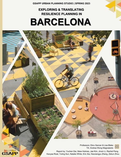
Exploring & Translating Resilience Planning in Barcelona
The client of this studio is the Barcelona Office of the Chief Architect of the Municipality, Daniel Alsina Torra. Special thanks to the broader Superblocks Team, Rosa Lopez and Neda Kostandinovic.
The office started the Superilles (Superblock) project in 2015, when the city’s Urban Mobility Plan incorporated the plan. The purpose of the Superblocks is to reduce vehicle dependency, by restricting public automobile access to the outskirts of the grid, thereby reducing pollution and emissions.
There are three main goals for the studio. The first is to critically examine the Superblock model in Barcelona, exploring it within the larger concept of resilience. The second is to understand the opportunities and challenges brought by this urban model. The last goal is to develop recommendations on the applicability of the Superblocks model for other urban areas at large.
Spring 2023
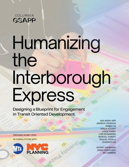
Humanizing the Interborough Express
The lnterborough Express is a new light rail rapid transit system that will connect areas of Brooklyn and Queens and utilize an existing freight rail right-of-way. The MTA and the Queens and Brooklyn NYCDCP offices are key planners of the project and our studio clients. At the beginning of the semester, we met with the leadership of these agencies. We were presented with the problem of connectivity for the IBX’s proposed stations in the major transit areas of Jackson Heights in Queens and Middle Village and Broadway Junction in Brooklyn. For example, the new light rail in Jackson Heights could further disrupt traffic and pedestrian flow on congested Roosevelt Avenue. The light rail may require tunneling under All Faiths Cemetery in Middle Village.
Our clients primarily desired design and engineering solutions to these connectivity problems. The studio course also focused on public engagement in city planning. To determine a direction for this project, we asked ourselves, is there an opportunity to establish a robust foundation for community engagement, relationship building, and inclusive development, given the early stage of the I BX project?
Spring 2023
Recalibrating Post-Pandemic Planning in Downtown Staten Island
The project client for this studio is the Chamber of Commerce of Staten Island. Founded in 1895, the Staten Island Chamber of Commerce (SICC) is Staten Island’s largest business organization. The Chamber strives to improve the economic climate and expand business opportunities for all Staten Islanders.
SICC represents and advocates for more than 14,000 businesses across all shores of Staten Island. SICC has over 700 members that represent all types of business categories. The Chamber plays an integral role in supporting businesses of all sizes across the island with an emphasis on local, small business growth. Throughout the project, we have worked closely with Janet Dugo, the project manager for the Downtown Staten Island Commercial District. Janet is deeply involved in the commercial landscape in the neighborhoods of St. George, Tompkinsville, and Stapleton. In 2018, Janet and the Chamber worked to produce a Commercial District Needs Assessment. The CDNA consecrated the existing business landscape and highlighted the need for several improvements. Before the pandemic, SICC began the process of creating a prospective Business Improvement District along Bay Street throughout Downtown Staten Island. The pandemic paused the efforts to formulate the BID. Now, this studio course aspires to consult the Chamber on ways of making the BID a successful, community-driven project that can serve as a mechanism for Downtown revitalization and placemaking.
Spring 2023
Infrastructures of Autonomy
This studio is a collaborative effort between architects and urban planners working with the community of Culebra, towards envisioning a sustainable, autonomous, and climate-prepared future for the island. According to the U.S. Census Bureau, Culebra is a small island with a population of 1,700 people, with a median age of 46 years, and a poverty rate of 23%. It is heavily dependent on tourism, transportation, and education to sustain its economy.
In order to achieve a more autonomous and climate-prepared community, the studio team working on this project has adopted a bottom-up, community-led approach to design, challenging traditional, centric models of urban development. The project is organized around five themes: Memory, Coastal Resilience, Housing, Energy, and Food, with the goal of creating a more autonomous and climate prepared community.
Fall 2022
Joint Historic Preservation/Urban Planning Studio
The Joint Historic Preservation and Urban Planning Studio engaged in an exploration of the policies and best practices in place surrounding the use of heritage places like historic buildings, streetscapes, settlements, and cultural landscapes in on-location film production. The studio sought to develop new approaches to encourage positive changes towards preserving the integrity and environmental qualities of historic places, minimizing risk while equitably benefiting communities, and respecting the related socio-spatial relationships of place. The studio offered students an opportunity to reflect on global case studies related to the challenges and benefits of heritage filming. Students later applied their findings in a visit to Alabama in cooperation with the Alabama African American Civil Rights Heritage Sites Consortium to examine representation for sites related to the American civil rights movement.


Courses
Spring 2023
Advanced Spatial Analysis
This advanced seminar examined and developed techniques of spatial analysis and representation specific to urban contexts. The course centered around key methodologies including advanced spatial statistics, spatial decision support systems, feature recognition, and interpolation, interrogating their use and applicability to different contexts in research and practice. Through case studies, students learned several new methods, comparing distinct approaches to similar questions and considering the implications—ethical and otherwise—of spatial analysis and cartography.

NEIGHBORHOOD CHANGE IN NEW YORK CITY Evaluating Neighborhood Change from 2010 to 2019 in New York City
Research Questions:
Where is neighborhood change happening in NYC?
How is neighborhood chan…
Honey, I Shrunk the City! Comparing Measures of Urban Change Against Proximity to Wildfires
Introduction
Since the 1950s, California wildfires have become increasingly
frequent and more…
Up-Zoned Out
How have varying demographic and housing characteristics of neighborhoods changed relative to u…
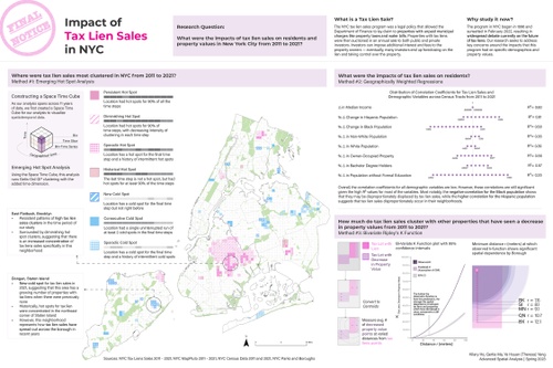
Impact of Tax Lien Sales in NYC
Research Question:
What were the impacts of tax lien sales on residents and
property values i…
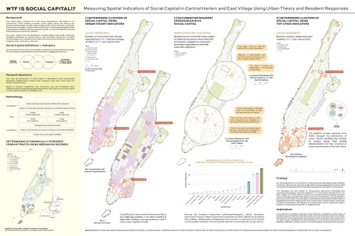
WTF IS SOCIAL CAPITAL!? Measuring Spatial Indicators of Social Capital in Central Harlem and East Village Using Urban Theory and Resident Responses
Civic fabric plays a critical role in the social empowerment and health of our communities. Urba…
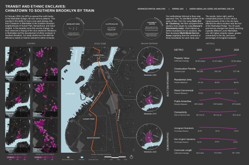
TRANSIT AND ETHNIC ENCLAVES: CHINATOWN TO SOUTHERN BROOKLYN BY TRAIN
In February 2004, the MTA re-opened the north tracks of the Manhattan Bridge with new service pa…
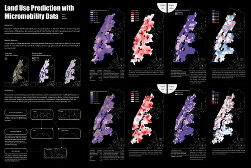
Land Use Prediction with Micromobility Data
This project employed shared micro-mobility data from static stations to determine the land use s…
Spring 2023
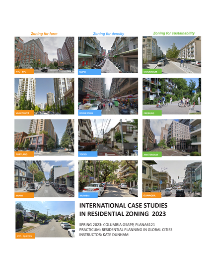
Residential Planning in Global Cities
As the world’s urban population grows towards six and a half billion by 2050, cities all over the world are resorting to the mass-production of residential super-blocks to address new urban housing demands. But is this model appropriate for all cities regardless of their environmental, social, political, and economic differences? This seminar provided students with the opportunity to understand how planning regulations —specifically residential codes—shape the design and functioning of urban neighborhoods. Students worked in teams to develop zoning case studies of distinctive residential districts selected from global cities and explored ideas about how regulatory codes can address the challenges that come with unprecedented urban expansion.
Fall 2022
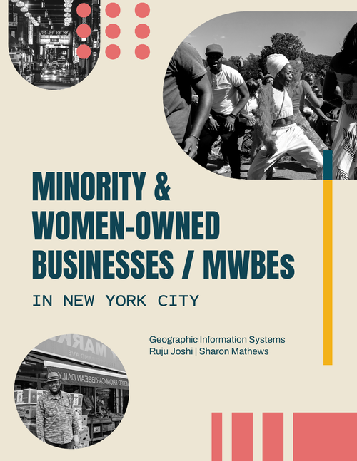
Geographic Information Systems
This course introduced core concepts of geographic information systems and science (as well as technical skills) critical for working within urban environments. Students learned critical approaches to spatial analysis and visualization techniques as well as data acquisition and management, spatial research methodologies, and cartographic principles through a combination of lectures and focused lab sessions.
Migrant Support Systems in Sanctuary Cities: Analyzing Select Destinations of Governor Abbott’s Refugee Removal Program
Are certain destinations of Governor Abbott’s refugee removal program better alternatives for the…

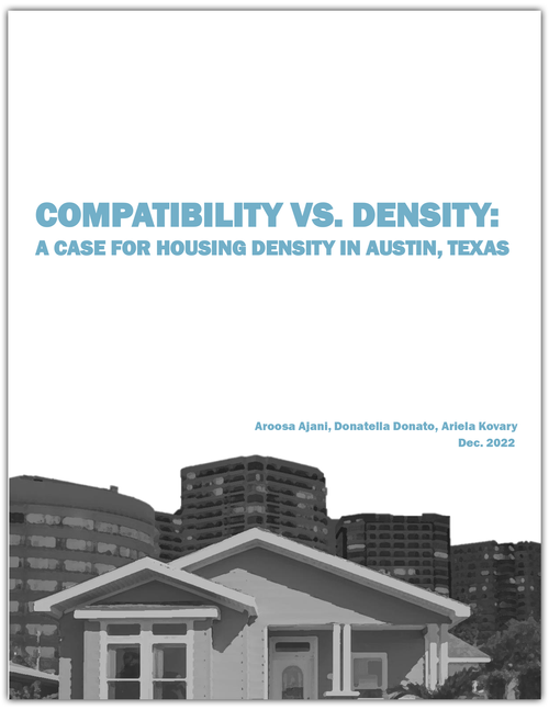
COMPATIBILITY VS. DENSITY: A CASE FOR HOUSING DENSITY IN AUSTIN, TEXAS
Fall 2022
Urban Design for Planners
How should urban designers give shape to the city? What urban design methods could they apply? This course helped students acquire the principles that can inform urban design practice. It held three major pedagogical objectives. First, it helped students understand the contemporary city through a series of urban design tools. Second, it covered both historical and modern urban design principles. Finally, it included all the scales in which urban designers operate, ranging from the fundamentals of social interaction in public space, to environmental sustainability of a region. The course was structured around the most typical problems that urban designers are asked to solve.
Fall 2022
Future Mobility Workshop
Large-scale human mobility data can be collected from mobile phones, road surveillance cameras, and location-based applications. At the same time, opportunistic methods reveal movement patterns from the data exhaust of our everyday lives. This data can provide insights into how cities (and their citizens) operate, and transportation companies are using such claims as the reason for deployment. This course served two purposes at this nexus: it allowed students to gain insight into how existing and novel data can (or cannot) be used to assist in mobility planning and to engage in what future practices are emerging in urban mobility. The first goal of this class was to expose students to general methods that extract useful information from digital traces of human movement, covering numerical methods to ascertain the structure inherent in daily activities within a population. The class considered opportunities and limitations for planning and questioned the biases implicit in using these datasets. The second goal was to engage students in the policy debates that are emerging in cities around companies, practices, and devices that utilize technology. The class engaged in data analysis, locative technology development, and interpretation and policymaking by drawing from the context and challenges of urban mobility hollistically.

Theses and Capstones
1
Urban Planning Class of 2023
SARAH ABDALLAH
Advisor: Hiba Bou Akar
Visions for NEOM
TAMIM ABEDIN
Advisor: Tom Slater
Riding to the MARTA Market: Transit-based Food Access in Atlanta
KIRTHI BALAKRISHNAN
Advisor: Anthony Vanky
Computer Vision for Ethnographic Research: Finding Visual Predictors of Neighborhood Demographic Changes
This thesis proposes a novel computer vision method for conducting large-scale and automated analysis of the commercial landscape of cities over time. The method employs ML techniques and leverages street view imagery to extract and analyze visual information, such as colors and languages used across storefronts, to identify changes in the characteristics of ethnic enclaves in cities. The paper argues that this method could be used in the context of ethnographic research to study the cultural practices and beliefs of communities in cities like Detroit, New York, and Los Angeles, and to develop a digital tool that maps the quantifiable changes in the characteristics of ethnic enclaves over time. By using qualitative data to draw causal inferences between these changes and events that may have had an impact, the tool could be used by urban planners and sociologists to better understand and predict urban change in the context of ethnic enclaves and cities. The paper also proposes a framework for incorporating this data into urban planning and sociological research, providing a basis for further study in this area.
ZHIHAO BAO
Advisor: Anthony Vanky
Parking Future of New York City with Deployment of Shared Autonomous Vehicles: A Discrete Event Simulation Model
The impact of Shared Autonomous Vehicles (SAVs) on urban development patterns, land use, and transportation planning is an essential topic of investigation for contemporary urban planning. This study examines how the introduction of electric SAVs affects parking space distribution and land use in New York City. The research questions explored include: How does the distribution of parking spaces change after implementing an electric SAV system? Which neighborhoods are most vulnerable to SAV-induced changes as these vehicles prioritize parking in cost-effective locations? And what land use policy recommendations can be proposed to address potential challenges?
The study reveals that the integration of SAVs presents a transformative opportunity to reshape commuting in New York City while also introducing challenges related to equitable parking allocation, social equity, and environmental sustainability. A multifaceted approach, including laws, regulations, incentives, taxes, subsidies, and public awareness campaigns, is advocated to ensure that SAV benefits are equitably shared and potential adverse consequences are minimized. The successful integration of SAVs into urban environments depends on the collaborative efforts of policymakers, urban planners, SAV operators, and the public in addressing challenges and maximizing the benefits of this innovative mode of transportation. Ultimately, this research emphasizes the importance of proactive planning and policy development to create sustainable, accessible, and thriving urban communities for future generations.
NATALIE BARTFAY
Advisor: Hugo Sarmiento
Offshore wind ports and the Just Transition: Community-based planning and development in New York City’s industrial waterfront
This work analyzes the conditions and capacity for equitable development processes in industrial maritime neighborhoods subject to New York State’s burgeoning offshore wind industry, anew development instrument will direct hundreds of millions of dollars into waterfront communities in decline. In particular, this research engages with the waterfront redevelopment of planned “offshore wind ports” with a Just Transition framework. The Just Transition framework is a best practice for green infrastructure development and champions equitable development processes in a shift towards green economies. This research focuses on its principle of self-determination and engages in the complex physical relationships of these industrial sites, asking: how can community-based planning priorities, strategies, and actors work to guide this green waterfront development?
Using a case study-based approach, planned community-level development is elevated for Sunset Park, Brooklyn, the home of New York’s first planned wind port (South Brooklyn Marine Terminal) and the southwestern shore of Staten Island (Arthur Kill Terminal, Rossville Municipal Site, and the Staten Island Marine Terminal), projects support by the New York City Economic Development Corporation’s 15-year, $191 million development program Offshore Wind NYC. The case studies compile the respective neighborhood’s existing community-driven visioning, planning instruments, priorities, and perceptions of local industrial waterfront sites slated for OSW-related development and evaluate them against public and private development plans.
Ultimately, this research concludes that offshore port development in New York City offers significant equitable development potential to underserved waterfront communities. However, the scale of community benefits and equity largely depends on existing community advocates, power, and planning tools, benefiting communities with a robust socio-political infrastructure and indicating that a Just Transition is by no means inherent—or easily achieved—to this green industry. Moving forward, the planning profession must support and expand hyperlocal community-based planning and engagement to truly leverage novel offshore wind development in the name of the Just Transition.
SEBASTIAN BIELSKI
Advisor: Anthony Vanky
Centro Francesco Datini Prato
Situated in the Greater Florence Metropolitan Area, Prato is Tuscany’s second largest city and has strong cultural ties to the textile industry and an industrial based economy. As the city continues to grow and diversify with new immigrant and refugee populations, the City of Prato is working with the City of Florence to extend the current tram system from Florence to Prato to create better transit linkages for growing parts of the metropolitan region.
However, as no current metropolitan governing system exists, poor coordination has caused gaps in the existing and proposed transit networks. Thus, this project will work to first understand the mechanisms of mobility at the city level by identifying new transit modes that can connect the proposed tram to the city center and central rail station - the two connections that are missing within the proposed system.
Centro Francesco Datini Prato will be a large scale redevelopment project of the Ex Banci in Prato. It will have four unique zones, but unified by several key design moves. One, there will be a cycle superhighway built through the site going north to south. This will help people move into the site and connect pedestrians to the city center and Prato Centrale.
This capstone’s primary purpose is to provide project visioning in the form of design solutions. Secondarily, the capstone wil provide design and policy recommendations to inform the future regeneration of the site.
The primary mode for analysis is the ethnographical approach. The ethnography centers on understanding the human experience in the space. It identifies microcultures and creates an initial redesign based on site and visual analysis.
ARIANA BON-HODOYAN
Advisor: Hiba Bou Akar
Caring for Abolition (Park): The Spatial Politics of Care
Care is a fundamental aspect of human existence, encompassing everyday acts of interdependence that sustain human relations, social structures and economic systems. However, caregiving is subject to larger systemic forces and institutions, which has resulted in a crisis of care structures and the conditions under which it is given. Patriarchal systems of power have historically undervalued care by feminizing and naturalizing unpaid care labor as innate to women and by providing low wages, poor working conditions, and inadequate recognition for paid caregivers. To ensure adequate care, it is crucial to consider the spatial dimension of caregiving, as the built environment can affect the quality of care and conditions for caregivers. However, disciplines related to the built environment have primarily focused on the public realm and overlooked how gender and race shape power dynamics within households and communities. Urban planning can address this by exploring ways to address the unequal dynamics of the private sphere, which significantly impact people’s experiences with the built environment. This thesis therefore addresses the spatial aspect of care to challenge the invisibility of care work, and argues for the need of a comprehensive approach to understanding and theorizing care in the context of the built environment. Such an approach enables us to examine how care is influenced by the built environment and transformed into spatialized networks that can enhance the quality of care, improve the conditions under which it is provided, and elevate its value and recognition.
In 2020, the world witnessed the occurrence of a global pandemic and a racist epidemic of violence at the same time, exposing the inability of traditional networks to respond adequately. In response to this, pandemic mutual aid groups emerged as alternative means of providing care, while people across the United States organized protests against racist police violence and brutality, sparked by the killing of George Floyd. Throughout history, mutual care strategies have been crucial in Black, Indigenous, and People of Color (BIPOC) communities, and the pandemic underscored their fundamental role in collective survival. Drawing from the work of organizers, feminists, critical geographers and scholars, this thesis interrogates understandings and practices of care by analyzing caring networks that developed in the protest site known as “Abolition Park” in Lower Manhattan during the summer of 2020. It discusses the politics of care to counter its low-visibility and interrogate the ways in which caregiving is socially and politically organized. Building from the resourcefulness and perseverance of caregivers and activists, this thesis aims to promote a care-centered perspective in urban planning that prioritizes caregiving practices within the built environment. By analyzing the spatial networks of care developed in Abolition Park, we can gain valuable lessons for urban planning that encourage the recognition and support of care, as well as equitable distribution of caregiving responsibilities to alleviate the disproportionate burden currently placed on women, particularly women of color, due to systemic racism and gender-based stereotypes. To enhance the significance of care, it is crucial to promote a care-centered approach in urban planning and to take action to advance a just care system.
CHRISTIAN BUDOW
Advisor: Anthony Vanky
Shinkansen versus InterCity Express, which Net-work is more suitable for Texas?
Texas is the fastest-growing state in the United States by population and economy. Its existing transportation infrastructure cannot keep up with the pace of growth, leading to increased congestion problems. Texas Central proposes a high-speed rail line between Dallas and Houston as a solution. This paper researches if this proposal can solve congestion between Dallas and Houston and, in a larger context, Texas. First, it examines the existing passenger traffic flows and predicts the ridership for a passenger rail network. Then it compares the Japanese and the German approach to high-speed rail. While Japan created a monocentric network, Germany built a polycentric one. The thesis will compare both systems and discusses how their different method to the structure applies to Texas. This paper aims to bring a deeper understanding of high-speed rail networks to Texas and how a sustainable transportation system utilizes all available modes.
JIDONG CAI
Advisor: Leah Meisterlin
Hudson Yards for Whom: Analysis of the Contribution of Hudson Yards in High-quality Public Space to New Yorkers
This thesis examines the extent to which Hudson Yards, a large-scale mixed-use development in New York City (NYC), fulfills its commitment to providing high-quality public spaces for New Yorkers. The study focuses on three main aspects: accessibility, diversity, and place identity. Employing a mixed-method approach, including site observation, GIS service area analysis, site plan analysis, tweets analysis, and an examination of historical public events and programs analysis, the study found that the Backyard at Hudson Yards does not provide sufficient accessibility design for people with disabilities. Although the extension of the 7 subway line has made the site relatively accessible to the general public through public transit, the site does not offer an engaging environment that encourages frequent, recurring visits. The place identity is primarily tourism-centric, as most discussions about the site revolve around landmarks. In conclusion, the Hudson Yards development has not achieved success in providing high-quality public space. This study contributes to the urban planning literature on high-quality public space, large-scale private development, and privately owned public space development (POPS) with a case study. The findings of this study emphasize the need for more inclusive design and planning practices in private developments, as well as the importantce of understanding the implications of such developments on various stakeholders.
TOMAS CARRILLO
Advisor: Jenna Dublin-Boc
Policies in Concrete: A Tale of Two Mayors and Their Inclusionary Housing Legacies in New York City
This thesis explores the use of inclusionary zoning policies in New York City as a means of increasing access to affordable housing. With housing costs far outpacing incomes for many residents, the city’s affordability crisis has significant implications, particularly for low- and moderate-income households. Inclusionary housing policies require developers to include a percentage of affordable units in new construction, creating more diverse and sustainable neighborhoods. The policies have been championed by the mayoral administrations of Michael Bloomberg and Bill de Blasio, resulting in the creation of over 25,000 affordable housing units. However, there are also challenges to implementing these policies effectively, including ensuring that affordable units are genuinely affordable to those who need them most. By studying the successes and challenges of inclusionary housing policies in New York City, this thesis provides valuable insights into the potential of inclusive housing policies in urban areas.
MICHELLE CHEN
Advisor: Leah Meisterlin
Alerting the Masses: Examining San Francisco’s Emergency Public Warning Ecosystem
In conversations about emergency communication, multi-faceted redundant ecosystems are often touted as necessary to deliver important life-saving messages to the community. This paper evaluates the efficacy of San Francisco’s emergency alert system and the challenges the unique urban landscape of a diverse city poses to urban planners in creating emergency communication channels. It aims to understand the significance of using a multi-faceted emergency alert system and each channel’s role and significance in the San Francisco emergency alert ecosystem. The paper uses the unique circumstance of the shutting down of San Francisco’s public siren system in 2019 as a backdrop to examine alternative communication networks. This paper calls for a more comprehensive emergency alert system that is accessible and reliable, as well as a focus on increasing emergency preparation in communities. Analysis of San Francisco’s current emergency alert system as of 2023 suggests that there are vulnerabilities, showing gaps in coverage and channels that are singular points of failure.
KIMBERLY CHEUNG
Advisor: Tom Slater
Preserving Chinatown: The Impact of Borough-Based Jails on Manhattan’s Chinatown
New York City’s historic Chinatown is an ethnic enclave that has supported generations of Chinese immigrants by providing a space for housing, work, and opportunities which are inaccessible to them elsewhere in the city. However, with increasing real estate demand and Chinatown’s prime location in Downtown Manhattan, the neighborhood has faced aggressive displacement practices like tenant buyouts, rent deregulation, and luxury (unaffordable) developments that has transformed the enclave. It has become increasingly difficult and unaffordable for Chinese residents to live in the area. In 2017, then Mayor Bill deBlasio elected to close down Rikers Island, New York City’s main jail complex within 10 years in favor of a “smaller, safer, fairer” program. In its place welcomed the Borough Based Jail system that will “create a network of four modern, more humane jail sites in Manhattan, Brooklyn, Queens, and the Bronx”.[1] The Manhattan based jail is sited to be in the heart of Chinatown, by demolishing and expanding the already existing Manhattan Detention Center. This has been met with intense pushback and public protest from the Chinatown community against the construction of the jail.
Following the disproportionate social and economic impact of the Covid-19 pandemic, existing trends of gentrification and displacement in Manhattan’s Chinatown, this essay attempts to detail the history of the project and the impact on the Chinatown community.
SEAN CHEW
Advisor: Anthony Vanky
Inclusive Transportation Planning: Empowering the Public via Digital Tools in Bus Planning
New York City boasts an extensive bus network that enables 94% of its residents to access a bus stop within walking distance. In 2019, the City’s bus ridership included 2.2 million riders on average on weekdays, and 678 million rides in 2019, which carried more passengers than the three next largest bus systems combined. Although the City’s bus system is extensive, bus service quality has frustrated many riders; New York’s buses run at the slowest bus speeds in the US at an average of 8 miles per hour. These speeds are caused by a multitude of factors, including frequent stops, passenger boarding delays, traffic congestion, and wait times at red lights. In 2021, the New York City DOT (NYCDOT) announced an ambitious plan, dubbed the Better Bus Action Plan, to improve service citywide via a host of initiatives, including new and improved bus lanes, expanded bus lane camera enforcement, and initiatives such as the Bus Network Redesign. The Better Bus Dashboard is a tool created to help demonstrate the potential for access to transportation data, policy information, and resources to empower individuals often left out of the conversation. This design brief presents research compiled for BetaNYC, the capstone client, so that the organization can effectively build the tool for the benefit of the public.
KIT NGA CHOU
Advisor: Anthony Vanky
Aging in Place: Planning for Intergenerational Play
My thesis explores the uses of playground and public space in New York City and Hong Kong (the two places I get to call home), to accommodate users from different age groups and support the exchange of sociocultural knowledge. The benefits of intergenerational interactions have been studied in social science, urban design, and planning lenses. Intergenerational studies, focus on the relationships and interactions between different age groups, parents and children, siblings, and grandparents and grandchildren. These relationships can have a significant impact on the well-being and development of individuals and communities, providing support, reducing isolation, and opportunities for connection. As the population ages and the cityscape continues to evolve, how can we promote positive intergenerational relationships in diverse settings, such as playgrounds and open spaces in public housing? This study suggests that although intergenerational interactions can be nuanced depending on cultural context––flexibility in infrastructure use, inclusiveness of placemaking, offering of a safe space, accessibility to nearby facilities, have all impacted the visitation of different age groups, and the mixing of visitors.
GABRIELLE COLEMAN
Advisor: Jenna Dublin-Boc
Preserving Place Identity & Place Attachments: Perceptions on Prioritizing Community Connections Over Urban Redevelopment in Harlem, NY
Once vibrant Black communities are falling victim to the social consequences of city growth from forces like profit-driven urban redevelopment and its consequent invitations of gentrification, displacement, and loss of place attachment. The study argues that preserving place identity is crucial in mitigating the process of cultural displacement and fostering community agency. Through a neighborhood case study, interviews, and a participatory memory mapping activity, this research demonstrates the forces connected to the existence and loss of place identity through an exploration of place attachments, feelings of connectedness, and a sense of belonging. Interviews with residents and community organizations revealed that place identity has been lost in Black spaces, local businesses, and recreation venues, but remains in streetscapes, parks, housing communities, and cultural establishments. The attributes of place identity loss include displacement, superficial preservation, asset devaluation, and insensitive developments. Conversely, the affordance of place identity includes community legacy, political agency, and thriving social networks. Positioning place identity as a tool of community agency, this investigation argues the preservation of place identity is a potential method for mitigating the process of cultural displacement and fostering community agency rapid urban change through an analysis of place relationships in Central Harlem, NY.
KEVIN COSTA
Advisor: Tom Slater
Has Crowdfunding exacerbated the financialization of housing in New York City?
The central research question of this thesis is to ask whether crowdfunding has exacerbated the nationwide trend of large financial institutions increasing their investments in and control over residential real estate in New York City. This trend is part of a process called housing financialization. Understanding this trend is vital for urban planners, as financialization has been shown to reduce the amount of affordable housing. Before 2015, only 3% of Americans could invest in most real estate projects. The 2013 and 2015 regulations associated with the 2012 JOBS Act enabled the other 97% to invest this way through crowdfunding. Simply defined, this refers to relatively large numbers of people investing relatively small amounts online in a specific project. The thesis uses a mixed methods approach to answer the central research question. Important websites were selected to measure the number of deals and amount of crowdfunding investment in New York City. Investments in two US cities with high land values, Boston, and San Francisco, are similarly measured. One crowdfunding portal owner was interviewed, as well as one of the original leaders of the crowdfunding movement that led to the JOBS Act. Several leading real estate executives were interviewed; although they all refused to speak on the record, it did help me form a greater understanding of the movement.
Financialization is not just a process but a heavily contested term with several definitions, some of which are related to crowdfunding. The process is an essential tool in promulgating neoliberal policies and programs. I argue that while crowdfunding has been indirectly promoted as being in opposition to neoliberalism, it ultimately appears to be serving its interests in the long run. Despite this, crowdfunding has the potential to create and preserve affordable housing and therefore slow the financialization of housing.
ROZETTE DE CASTRO
Advisor: Hugo Sarmiento
From Belonging to Being and Becoming: how urban planning can bridge the gap between immigration and a Just Transition, one recipe at a time
ELIZA DEKKER
Advisor: Jenna Dublin-Boc
Hot Market?! Assessing the Stability of Naturally-Occurring Affordable Housing In Terms of Extreme Heat and Market Pressure in Phoenix, Arizona
This project is presented in partial fulfillment for the Masters of Urban Planning Degree at Columbia GSAPP. Performed over the 2022-2023 academic year under the guidance of client Bloomberg Associates, this study assesses the relationship between neighborhood-level patterns of naturally occurring affordable housing (NOAH) and neighborhood stability through the lens of extreme heat and development pressure in Phoenix, Arizona. Using spatial analysis techniques such as multi-criteria decision analysis and geographically- weighted regression, this study establishes a spatial relationship between NOAH and neighborhood stability indicators in Phoenix, highlighting key geographies within the city to target for housing affordability and climate adaptation policy measures. Encouraging cross-departmental collaboration within the City, this study proposes policy recommendations such as easing financial burdens for legacy NOAH owners to developing extreme heat retrofit guidelines. Policy recommendations are intended to further the protection of the NOAH stock in Phoenix while ensuring that it remains a safe and reliable form of shelter for the city’s lowest income residents.
ZHAOXUAN DUAN
Advisor: Hiba Bou Akar
Imperialism, Urban Warfare, and Urban Planning: Russia’s Invasion, Governance, Rebuilding and Planning of Mariupol, Ukraine
This thesis examines the current situation in Mariupol, Ukraine, with a focus on Russia’s invasion and subsequent governance, rebuilding, and planning of the city from an urbanism perspective. The research begins by exploring the historical conflict between Russia and Ukraine and the significance of Mariupol to both nations. Through an analysis of the city’s urban context and the movement of Russian forces during urban warfare, the study assesses Russia’s determination to engage in conflict and its use of unique hybrid urban warfare tactics. The rebuilding and governance efforts of Russian authorities in occupied Mariupol are also analyzed, revealing attempts to eliminate Ukrainian influence and implement a re-Russification strategy. However, these efforts have been hindered by a lack of skilled workers, highlighting potential challenges for Russia in occupied territories. An examination of the master plan for occupied Mariupol reveals a mechanistic approach that lacks humanistic consideration, suggesting an unpromising future for the city.
Overall, this research exposes the imperialist nature of Russia’s invasion and governance of Ukraine and highlights the use of urban planning as a tool for imperialist warfare.
MARGARET HANSON
Advisor: Hiba Bou Akar
Playing With/In the City: An Observational Approach to Ludio Public Space Interventions in New York City
Literature surrounding playful cities has largely been limited to the idea of cultivating ‘child-friendly’ cities – those with plentiful playgrounds and public spaces geared towards children’s socioemotional health and cognitive development. The benefits of creating these spaces have been proven, time and time again, with clinical evidence demonstrating that as children spend more time outside in playful environments, they are relieved of negative emotions. Less literature has been dedicated, however, to the relationship adults may have with urban play. This research seeks to address how playful placemaking practices can create more just and participatory public spaces for adults. To this end, public spaces across New York City are used as cases, each centered on differing playful practices that have both been pre-determined by either city government, private firms, or organizations, as well as spontaneous, citizen-led play. This thesis seeks to understand both how municipal governments, not-for-profits, and neighborhood associations seek to program play into urban spaces, as well as how citizens take agency to define their own playful interactions with the city, often manipulating interstitial spaces to satisfy their specific needs.
CALVIN HARRISON
Advisor: Hiba Bou Akar
Preservation with a Donkey’s Leg: Nostalgia, Neighborhood Identity, and Heritage Preservation in Heliopolis
Initially built in the early 20th century as a real estate venture on undeveloped desert land, Heliopolis has, with time, become a beloved neighborhood of Cairo, considered part of the urban core and celebrated for its unique architecture, relatively abundant public space, and middle-class cosmopolitan milieu. However, the urban fabric has changed over time as Cairo’s population grew, and in recent years the neighborhood has lost much of its green space and pedestrian realm to road widenings and bridge construction aimed at drivers travelling to satellite cities like the New Capital. Using interviews, historic research, social media, and other sources, this thesis investigates the discourse mobilized by advocates for heritage preservation in the neighborhood, primarily the Heliopolis Heritage Initiative (HHI). It argues that the heritage discourse in Heliopolis is intimately tied to a spatialized nostalgia for the neighborhood’s past, but, because of constraints imposed by the Egyptian regime both in terms of heritage management and civic action, heritage preservation manifests in public awareness raising and profit-driven adaptive reuse. This raises important questions about the way heritage functions in the Egyptian context, how middle-class groups experience and respond to urban change, and the complexity (and contradictions) of heritage preservation and urban development policy.
NABILA FISRA HAWALI
Advisor: Hiba Bou Akar
Urban Politics of Land in Planning The New Capital City Nusantara, Indonesia
Capital cities relocations have occurred almost as long as capitals themselves. Capital cities, out of all classes of cities, have distinct characteristics not only for their respective nations but also uniquely contextualized to their geographical background. For Indonesia, the capital city is in progress to be relocated to a new location. The entire planned city will occupy thousands of acres of forest land in the East Kalimantan province, on the lush island of Borneo, which promises to be the country’s new identity with the new imagery of a smart, green, and sustainable forest city as opposed to the existing capital’s, Jakarta, urban environmental crisis. The allocated site as naturally important as Kalimantan has raised global concerns about how this plan will be materialized. This thesis is focused on the transformation of land which is currently being developed to site the future capital city of Indonesia. Seeing the interrelationship between politics, development policies, and the historical trajectory of how the land has been shaped, used, and transformed, this thesis explores the ways in which land is being acquired and utilized to materialize the plan to relocate the country’s capital city to a newly established city-region namely “Nusantara.” This thesis puts forward the importance of understanding the implications of land appropriation and its utilization for delivering major yet deeply political development plans and the way they shape certain transferability of rights, power dynamics, and flexibility in planning by examining the implementation of capital city relocation of Nusantara.
HILARY HO
Advisor: Anthony Vanky
Resilient Streets: Cloudburst Management and the Right-of-Way in New York City
Cloudburst events are occurring with increased frequency in New York City, posing serious flooding risks to residents. The city must find ways to work across agencies and coordinate governance processes to ensure that cloudburst management remains a priority in all major infrastructure decisions moving forward.
Building upon two policy windows, the 2022 announcement of the New York City Department of Environmental Protection’s (DEP) cloudburst management plan and the New York City Department of Transportation’s (DOT) 2022/23 commitments to expand the greenway network and bike infrastructure, this capstone—written in conjunction with Regional Plan Association—explores the possibility of integrating cloudburst management strategies within the right-of-way. In particular, the capstone explores the feasibility of interagency coordination surrounding climate resilient bikeways, constructed with the capital budget.
To investigate this topic, the capstone employs a mixed-methods approach: a precedent analysis of cloudburst management projects in the right-of-way from cities beyond New York City; semi-structured interviews with city agency representatives working at the intersection of stormwater management and right-of-way planning; and a spatial analysis of where new types of climate resilient bike paths could be located in New York City.
Key findings from a precedent analysis emphasize the importance of networked right-of-way infrastructure in connecting disparate cloudburst projects, integrating gray and green infrastructure, and creating standard guidelines to streamline green infrastructure within the right-of-way. Semi-structured interviews revealed the collaboration opportunities among city agencies when the co-benefits of green infrastructure are leveraged for right-of-way projects, the necessity of turning cloudburst projects into a larger program in order to plan for cloudburst management at scale, and the importance of mayoral and community buy-in to joint-agency cloudburst projects. Lastly, spatial analysis findings suggested that climate resilient bike lanes may have the potential to provide the dual impact of active transportation and flood mitigation particularly in outer borough neighborhoods, however, this intervention can only be effective if robust community engagement processes are built into the planning process.
As city agencies think through the next phases of cloudburst management for the city, these findings can help inform planning processes that not only facilitate interagency coordination, but also consider how community engagement protocols can be built into cloudburst management approaches in the future.
HAOCHE HUNG
Advisor: Leah Meisterlin
Evaluating Dashboards To Enhance Community Engagement For Street Trees
This capstone project aims to create a framework for measuring the effectiveness of civic data dashboards in promoting community engagement. To develop this framework, the project synthesizes 33 studies related to dashboards that employ different methodologies to evaluate their performance. The resulting evaluation matrix considers the relationship between methodology choices and effectiveness objectives, which vary depending on dashboard categories and their intended purposes.
The case study chapter illustrates how the evaluation matrix can be applied to explore the most appropriate methods for studying dashboard effectiveness across different objectives, from data quality to building capacity. The chapter also highlights the different approaches used by three dashboard cases to achieve community engagement under their own contexts.
Using previous research, the wireframe design creates a functional prototype of a street tree dashboard that aims to increase public awareness and encourage community participation in tree care and planting. The street tree dashboard prototype presents an accessible interface that connects local neighborhoods with the government service delivery process and inspires local residents to take action.
In summary, the goal of this project is to enhance community engagement by providing BetaNYC with an evaluation tool to assess the effectiveness of current dashboards based on their objectives and design new dashboards that better serve local communities. Through the evaluation matrix and case studies, this project provides a comprehensive guide for designing and evaluating civic data dashboards that promote community engagement.
CANDICE SIYUN JI
Advisor: Leah Meisterlin
*Public Space: The Critical Connection in a Sometimes Lonely City *
Loneliness is a critical yet often overlooked social issue with significant mental and physical health implications. The increasing prevalence of loneliness in recent decades, particularly in the wake of the COVID-19 pandemic, underscores the significance of public space as a critical platform for social connection. While extant research on loneliness and interventions to address the crisis laid the groundwork for understanding the state of the issue, gaps in current knowledge persist. In particular, there is a lack of consistent methods for measuring loneliness on a large scale, empirical evidence to support the link between loneliness and specific features of the built environment, and proof of efficacy of existing interventions at a local level. This study examines the extent to which public space features relate to visitors’ social connections and loneliness levels. Four pedestrian plazas and four community gardens in New York City are selected as case studies, focusing on neighborhoods with relatively greater racial diversity and lower median household income. Data are gathered from multiple sources, including observational data on the public life and documentation of physical features of all eight sites, a field survey that engaged over 180 visitor respondents, and interviews with 15 public space managers and designers. By investigating a diverse set of public spaces in New York City, this study provides evidence linking governance and public space design to the quality of social interactions and levels of loneliness among visitors. Seven key findings related to public space governance structure, programming, stewardship, openness, physical features, locality, and seasonality are outlined in the study. Insights gained from this study provide considerations for different stakeholders, including public space planners and designers, researchers, and city governments. By understanding and optimizing the influence of public spaces, conducting further research into effective strategies, and forming a coalition of efforts to address loneliness, cities can design for connection and pave the way toward better physical, psychological, and social outcomes for all.
DMITRI JOHNSON
Advisor: Anthony Vanky
Exploring the Effectiveness of 311 Data in Disaster Recovery and Response: A Case Study of Hurricane Sandy in New York City
This paper investigates the relationship between 311 complaint data and FEMA damage inspection data during Hurricane Sandy in New York City. A two-step research approach is employed: (1) correlational analysis to explore relationships between complaint counts by location type and FEMA-defined damaged housing units during Hurricane Sandy, and (2) linear regression analysis to identify significant predictors of total damage caused by incidents. The study reveals a strong correlation between Public Health and Environmental Hazards complaints and total damaged housing units, indicating their potential value in disaster recovery and response efforts. However, weak correlations and limited significance of certain complaint types highlight the need for caution when relying solely on 311 data. The findings suggest that integrating 311 data with traditional data sources can lead to more informed decisions and effective disaster recovery and response efforts. Practical implications include prioritizing Public Health and Environmental Hazards related complaints, utilizing 311 data alongside traditional sources, promoting timely reporting of relevant complaints, improving data collection processes, and implementing training programs for local authorities and emergency responders.
JAMES LAMMERS
Advisor: Tom Slater
Co-designing Public Spaces with Kids: Building PS32’s Community Fitness Hub Through a Semester-long Workshop Curriculum
The wider mission of building a Community Fitness Hub at PS32 The Belmont School is to help advance social, health, and public space equity in the Bronx, specifically East Tremont, which is one of the most underserved and at-risk communities in the city. This project is part of larger efforts exploring the role of ground up planning and public space activation in alleviating these issues of health inequity and increasing accessibility to active, safe, clean, usable, open, and fun public spaces.
My work focuses on elevating the voices of children through a co-design process used to build quality public spaces. Through a semester-long series of workshops with a class of second grade students at PS32, I discovered that co-designing spaces with children is hard, requiring a high level of commitment and a great deal of capacity for facilitators. However, this work is worth it, as it simultaneously empowers the kids, giving them ownership over the space the project is designing for, and educates young people about everything from planning and design to spatial awareness and wayfinding, all while creating more informed and equitable designs for the space that better serve the surrounding community.
Although small, this work can be a step not only in addressing deep inequalities present in East Tremont, but in giving young people the tools and inspiration to take more power over the spaces they inhabit. The result of this work is a replicable curriculum that can be taken and modified for other classes within PS32 and to other schools across the city.
YEA WON LEE
Advisor: Anthony Vanky
Evaluating the “Road to Reform” for New York City’s Property Tax System: Considerations for Single-Unit Residential Properties and Predictive Modeling as Practice for Local Governance
This paper evaluates possible effects of two policy recommendations provided by the New York City Advisory Commission on Property Tax Reform (‘Commission’) in 2021 to find that the Commission’s final findings find that the Commission overly simplify the extreme variance that exists in the New York City residential tax base in ways that distort the potential impacts of their recommendations and could be misleading for stakeholders and decision-makers. Second, the report offers little information that assesses the method and accuracy of their sales-price valuation assessment model. This paper provides exploratory findings from a predictive model that can be used to both understand the how the current assessment model operates, as well as to provide recommendations in utilizing machine learning to supplement local decision-making and innovate for market and socially responsive parameters for the new sales-based market value assessment model.
Finally, based on the findings from this methodology and literature review, this paper provides policy recommendations that will address three relevant issues identified in the current property tax system. Foremost, while the city can and should change the current property assessment model to a sales-based market valuation model, there must be more deliberation for the parameters used for the new model. Second, the current property tax policy environment is inefficient not only at the microeconomic scale expressed in the aforementioned disparities of property tax burden distribution, but also in the scale of municipal and state macroeconomics. Finally, a volatile political environment compromises prospects for a truly comprehensive reform, and any attempts for reform must center the political realities as a fixture of decision-making.
THIAGO LEE
Advisor: Jenna Dublin-Boc
The Civic and Political Engagement of the 1.5 and Second Generation of Korean Immigrants in São Paulo
The Korean immigrant population has created a significant presence in São Paulo, Brazil, over the past six decades, and the majority of its 1.5 and second generations are currently in working age. Formal surveys on the political and civic participation of the community is lacking, however anecdotal references are observable: many ethnic associations have emerged and waned over the decades, while changes in economic conjuncture have recently propelled the creation of new ones; a handful members of the community attempted to be elected for political positions but none has yet succeeded; Korean churches are common catalysts for civic services for vulnerable groups. This research aims to understand how the 1.5 and second generation are presently involved in civic and political activities and to contribute to the discussion on its determinants. A historical study on the community and its main ethnic enclave – the neighborhood of Bom Retiro – was conducted followed by a literature review on conceptualizations about immigrants’ identity and their relationship with their community and the host country. The latter involved studies from the fields of political sciences, sociology and urban design and was the foundation for semi-structured interviews that ensued, in which members of the 1.5 and second generation from diverse backgrounds were interviewed and their responses analyzed. From these incursions, this thesis proposes a new understanding of the civic and political engagement of the Korean community in Brazil and look into its possible future developments.
THEODORE LEVENTHAL
Advisor: Hugo Sarmiento
A Comparative Study of “Green Corridor” Climate Change Adaptations in Barcelona, Spain, and Medellin, Colombia
This thesis compares the experience of planning and implementing “green corridor” climate change adaptations to the built environment in Barcelona, Spain, and Medellin, Colombia. The paper documents the Urban Heat Island Effect of climate change in both cities, as well as pollution rates produced by vehicular traffic. This paper argues that in both cities green corridors were preceded by a series of successful changes to the built environment conceived by unconventional, creative public officials and based on a “Social Urbanist” planning philosophy–creating infrastructure, facilities and public spaces serving marginalized communities and integrating them into the greater city. Research found that in Medellin, Social Urbanist policies reduced violence and alleviated poverty, were very popular, and fueled support for an extensive and ultimately successful green corridors program. In Barcelona, however, while previous Social Urbanist policies have been successful and quite popular, the “Superblocks” plan for green corridors is the most radical plan to date, has divided public opinion and its fate hangs in the balance.
VICTORIA LIN
Advisor: Tom Slater
No Country for Old Chinatowns: Better Cultural Governance of Toronto’s Chinatown West
Chinatowns in Canada and the United States have been subject to similar planned destruction, displacement, and redevelopment patterns, reflecting broader trends in urban ethnic enclaves. Competition among metropolitan regions for talent and investment has driven a demand for growth and neoliberal policies but also results in gentrification despite politicians’ promises of increasing housing affordability in Toronto. A diverse variety of communities, businesses, and government stakeholders aim to protect these enclaves but have different ideas of what to prioritize economic development or the cultural heritage of Chinatown West. In this study, I examine the influences shaping Chinatown’s development, including displacement, uneven real estate development, and cultural preservation. Legacy businesses, Chinese signage, and mixed-use functionality contribute to the community’s character. Despite an influx of international students and young professionals, the residential demographic relies on the neighbourhood’s businesses. Toronto’s development-driven nature, driven by planning strategies and recent political changes, challenges Chinatown West. Civic organizations provide support, but legacy businesses face obstacles such as high property taxes and competition from international chains. The neighbourhood must consider whom it aims to preserve for, given changing demographics and the appeal of ethnoburbs. This thesis explores threats and opportunities for development and preservation, proposing policy and land use activism solutions.
MOLLYE LIU
Advisor: Tom Slater
The Preservation and Expansion of Non-market Rate Housing in the Upper West Side
The Upper West Side of New York City is facing significant housing insecurity, with many residents struggling to afford rent and considered cost-burdened. Affordable housing has become more crucial than ever, given the skyrocketing rents and housing prices in the area. This project aims to address the preservation and expansion of affordable housing in the Upper West Side through a current situation analysis and future planning.
The project seeks develop an inventory of existing non-market rate housing programs in Community District 7 Manhattan and analyze their demographic characteristics to determine the housing needs of the community. Additionally, the project quantifies the increase and decrease of rent-stabilized units over the past decades, identify opportunities for renovation and conversion to expand the housing supply, and create an online interactive map to help residents access available housing programs.
The researcher also identifies and proposes future affordable housing development and conversion opportunities, considering the intentions and concerns of local organizations and developers. The documentation of past and existing conditions will enable Community Board 7 Manhattan (CB7/M) to better advocate for all residents and expand their data on buildings suitable for conversion to affordable and supportive housing.
Overall, this capstone project provides a comprehensive analysis of the housing situation in CB7/M and proposes solutions for future affordable housing development and conversion opportunities in this area. The findings and recommendations of this study can be used by the CB7/M Housing Committee and other stakeholders to inform policy and decision-making related to affordable housing in this area.
The research product also includes inventory databases and online interactive map, which can be accessed via CB7/M’s official website.
MOHENG MA
Advisor: Tom Slater
The relationship between infrastructure and land use patterns in New York City and cardiovascular disease risks
Cardiovascular disease is currently one of the chronic diseases with the highest mortality rate in the world. By using open data and taking a total of 15 sub-categories of indicators in the three categories of socio-economy, natural environment and built environment as independent variables and the 2018 New York City Census tract scale of coronary heart disease prevalence over 18 years old as a dependent variable, the census tract scale cardiovascular disease risk is modeled in this paper. Also, Morans’I and GWR regression methods are used to analyze the relationship between built environment factors and the risk of cardiovascular diseases, with socio-economic indicators and natural environment indicators as control variables and built environment factors as main variables. The effect of built environment factors on cardiovascular diseases has been found to be spatially heterogeneous. The GWR model can effectively improve the accuracy of OLS models. At the mesoscale, different factors have different impacts on cardiovascular disease. There is an obvious negative correlation between medical facilities, parks, public spaces, and compact land use patterns and cardiovascular diseases. Parks, medical facilities, public spaces, and public safety are more important in areas lacking them than areas where such facilities are available. Urbanization creates health inequalities, and we need to talk about this in a larger context.
NIKOLAS MICHAEL
Advisor: Hugo Sarmiento
Rumor Has It: Networks of Informal Communication as Resiliency on Hillside Avenue
On September 2, 2021, Hurricane Ida dumped record rain on New York City, leading to the tragic deaths of 11 people, including a mother and son in a basement apartment just south of Hillside Avenue in Hollis, Queens. While resiliency planning has been critiqued by scholars such as Kathleen Tierney, it is still the go to framework with which urban planners engage with the climate crisis. Scholars like Malini Ranganathan and Eve Bratman would argue that to truly understand what happened on Hillside Avenue and to build a real and critical resiliency, we must use the framework of abolitionist climate justice to uncover the networks of care that exist in the neighborhood and what spaces those informal networks inhabit. If abolition can be understood as “unfinished liberation …[from] processes of hierarchy, dispossession, and exclusion that congeal in and as group-differentiated vulnerability to premature death” (Gilmore, quoted in Ranganathan and Bratman, 2019), then a framework of abolitionist climate justice on Hillside Avenue must be understood in the context of the multiple immigrant communities that call it home and their relationality to one another, the state, and the larger social forces that construct risk in New York City.
This research engages with archival materials, semi-structured interviews, and ethnographic observations that explore the informal networks of care and communication that weave throughout Hillside Avenue. From the starting point of understanding how these networks function to keep people safe during climate crisis induced events like storms, it also explores the ways in which they keep people safe from the societal ills that increase precarity and vulnerability, such as housing instability and food insecurity. It frames these networks of care not just as protective measures by populations who the neoliberal state neglects, but as iterating, everyday, and radical acts of joy that do political work in destabilizing systems of domination by virtue of their existence.
CARLOS MIRANDA PEREYRA
Advisor: Jenna Dublin-Boc
Shareholder Expectations and Experiences with NY HDFC Cooperatives
New York city is currently facing an affordable housing crisis. In an attempt to solve this issue, tackle the problem of neglected buildings, and provide an opportunity to uplift communities through homeownership, the city and its residents have been exploring housing cooperatives as a potential solution. Unfortunately, the HDFC production and purchasing processes can be incredibly long, arduous, and expensive. Through this project, I seek to better understand the experiences of shareholders of HDFC cooperatives as they purchase or participate in the development of their homes. Through interviews, I explore the HDFC accessibility, both in financial and non-financial terms. I find that the HDFC program is a lot more complex than initially assumed. I also find that the HDFC acquisition process is generally a negative experience across the board, but in the end shareholders seem to be satisfied with their homes. To improve upon the existing structures, I encourage public entities involved in HDFC development to improve their communication regarding HDFC processes and requirements.
HAZEL NI
Advisor: Hiba Bou Akar
Public-Private Partnership in Affordable Housing, Comparing current practices in Jinhua, China and New York City
This thesis aims to investigate the roles of public-private partnerships (PPP) in the affordable housing industry. This thesis examines the “Agent Construction System” (ACS) business model in affordable housing development in China, the Low-Income Housing Tax Credit (LIHTC) system for affordable housing in United States, and more specifically, the New York City Housing Authority’s Permanent Affordability Commitment Together (NYCHA PACT) program to bring private partners into public housing in New York City.
Conscious of the difference in the local social, political and economic environment, and hence the vast varieties in the practices of PPP in housing, the literature review will provide an overview of the concept of PPP in affordable housing, and its practice in different countries. Current literature includes discussion on the application of PPP in housing in cities including Kolkata, India, and Hong Kong, as well as broader discussions on such us in countries including Malaysia and Nigeria.
In China, the “Agent Construction System” (ACS) is a line of business that gained increasing attention over the past several years in the real estate industry . The ACS was first officially defined by The State Council of the People’s Republic of China in 2004 in the “Circulars on Investment Modes Reform”, which defined it as a process in which by means of bidding, a professional project management unit is selected to be responsible for construction, implementation, in order to strictly control project investment, quality and duration, and is responsible to hand over to the user after completion acceptance in non-profit government investment projects.
In United States, LIHTC has been used as the most prevalent funding source for affordable housing since the late 1980s. This research will examine the background of its establishment, and explore the reasons behind its effectiveness and longevity. In New York City, NYCHA PACT was launched to bring in more private involvement to provide funding for major renovation of the NYCHA housing stock. The program has been successful generating additional funding for NYCHA but also faces controversy. This research will also explore the different facets of the success and challenges in NYCHA PACT.
The research method will be primarily qualitative and include case studies, and interviews with professionals and scholars. It includes a history on the development of the Agent Construction System, and examples of how it has been implemented, from one case study of a project by Greentown Management. It will include a discussion on the role of public-perception and comparable precedents that those companies in China model from, notably from the public/affordable housing model in Hong Kong and Singapore. It will also include a discussion on the use of LIHTC in affordable housing, its advantages and shortcomings, success and challenges through NYCHA PACT, and the role of non-profit in the affordable housing industry in United States.
The research will discuss on the definition of success, the local conditions that seem facilitating to the development, and the specific strategies implemented by the public sector and the private firm to ensure the double bottom-line return, achieving both financial feasibility and social benefits.
ALISA NURMANSYAH
Advisor: Jenna Dublin-Boc
Equity in Visitation in Remote-Access Public Green Spaces: Exploring the History, Management, and Perceptions of Governors Island
This study will look into how Governors Island can become a more equitable, accessible, and creative open space and cultural institution for all residents of New York City. Governors Island is considered a remote and difficult-to-access public green space. Visitors have been skewed to a single type of population coming from more well-off neighborhoods with better access to the Island. A survey, semi-structured interviews, and spatial analysis will be conducted to uncover the perceptions of remote public spaces–if people’s perceptions are affected by many variables, including its historical context, the current marketing of the space, or physical accessibility reach. A spatial analysis surrounding neighborhood demographics will describe and contextualize visitors’ neighborhood conditions. The survey covers people’s thoughts on the park and rating its accessibility, comfort, and activities available. Due to concerns regarding the number of responses to the survey, interviews will also be conducted with professionals to gather their professional opinion on what it means to create equitable parks and why Governors Island may have yet to be able to do so. The results of these procedures suggest that visitation to Governors Island is motivated by an interest in recreational space and the unique experience that the Island provides. Generally, existing visitors and peer organization leaders have a favorable view of the Island. Based on the data, visitors mainly come from waterfront communities with quick access to the ferry- specifically from the wealthier and less predominantly minority-populated waterfront communities of Lower Manhattan and Downtown Brooklyn. Negative perceptions of difficulty of access, requiring more maintenance, and a mismatch of goals and actions for increasing equitable visitation to increasing leases with high-end vendors may not deter current visitors of the Island but creates a specific image of the Island. Ultimately, the biggest challenge the Island faces is the need for immediate access to the Island that most PGSs have. Expanding physical access should be a goal to achieve, but incorporating more thoughtful community input into the development of programming and activities on the Island should also be incorporated. Appropriate place branding of the Island is also a priority.
GERYEL ORIANA OSORIO-GODOY
Advisor: Jenna Dublin-Boc
Beyond the Built Environment: Making Space for the well-being of BIPOC planners
This thesis explores the spatial experiences of Black, Indigenous, or other People of Color planners as they negotiate the use of spaces in their personal lives and professional settings, especially as it relates to their mental health and well-being. Prior research has shown significant gaps remain for groups historically and structurally excluded from the planning profession, including those who are Black, immigrants, or LGBQT+. Current urban planning practices fail to consider how workplace health and well-being are a continuous process that integrates conditions of traumatized landscapes. Planning literature has an opportunity to adequately address the role of a racialized planner, especially if they identify as queer, in actively participating in processes that help them navigate the emotional tolls which result from planning work. Such an examination offers an opportunity to explore the possibilities and challenges of healing-centered engagement. This paper brings light to the creative avenues that BIPOC planners engage with as a means of self-preservation, advocacy, and liberation. It also argues that the connections between BIPOC planners’ creative space-making practices and their role in workplace settings are inextricable from each other. Thus suggesting that it is urgent for urban planning to adopt alternative approaches to workplace culture and community engagement practices to cultivate spaces that are caring, affirming, and just. BIPOC mental health is a workplace issue and should be better integrated into efforts of diversity, equity, and inclusion.
ROBERT SANCHEZ
Advisor: Hugo Sarmiento
Smart Sustainable Cities’ Use of Information and Communication Technologies to Meet the Nations’ Sustainable Development Goals: A Case Study of Fujisawa Sustainable Smart Town
This thesis explores the emerging “Smart Sustainable City” concept that incorporates Information and Communication Technologies (ICTs) to foster sustainable urban development. The concept is defined and contextualized using existing literature, and the role of ICTs in Smart Sustainable Cities and their connection to meeting the United Nations’ Sustainable Development Goals (UN SDGs) is established. The current challenges and limitations facing the Smart Sustainable City Model are also discussed. This thesis presents an international case study: Fujisawa Sustainable Smart Town (SST) Project in Fujisawa, Japan. Following a historical account of Japan’s urban planning system, the case study overviews the development process of the Fujisawa SST project, highlighting the implementation of ICTs in the town in comparison to its local context, and establishes how the town’s ICTs work to meet the UN SDGs 7, 11, and 17 (Clean and Affordable Energy, Sustainable Cities and Communities, and Partnerships for the Goals). The case study has incorporated a site visit to Fujisawa SST and interviews with stakeholders involved in the governance of Fujisawa SST that were conducted by the researcher. Findings from this thesis and the lessons learned from the case study are intended to serve as a resource for potential future Smart Sustainable City development.
MATTHEW SHORE
Advisor: Jenna Dublin-Boc
Crown Jewel of the Bronx or Nail in the Coffin? Assessing the Kingsbridge Armory’s Public Visioning Process & Buy-in for Community Ownership in the Northwest Bronx
ESHWATTI SOOKRAM
Advisor: Leah Meisterlin
Braving the Storm Together: Building Social Cohesion for Local Climate Adaptation Planning in New York City
When Hurricane Sandy devastated New York City, it was a catalyst for urban planners and practitioners to ponder the steps and timeline needed to prepare for climate-related disasters. As part of the strategy to implement more community-based climate planning, New York City also recognized local communities’ strength and ability to provide for themselves and their neighbors in the wake of this disaster. Thus, social cohesion became a necessary component of climate planning to build resiliency. Social cohesion is a multi-faceted concept encompassing positive social relationships, trust, participation, a sense of belonging, and inclusion of all groups within a society. It depends on the strength of relationships within and across demographic divides, ensuring equitable access to opportunities and resources and inclusion in civil life, all to prevent alienation and promote a strong social fabric. This research includes a qualitative comparative analysis of three New York City neighborhoods whose organizing efforts built significant climate resilience for their communities: Sunset Park in Brooklyn, Flushing in Queens, and Battery Park City in Manhattan. This study aims to investigate the role of social cohesion in the three different neighborhoods’ resiliency efforts through preventive and defensive measures. More broadly, this research hopes to understand the nuance in different community-based organizations’ strategies to be resilient vis-a-vis social cohesion. The findings of this research support the idea that social cohesion is not the only path to resiliency, but rather an overarching strategy that can help fill gaps. Growing out of social cohesion, local knowledge building, allocation of funds, political mobilization, and coordination are several mechanisms for adequate preparation for and recuperation from the ramifications of climate-related events.
VARISA TANTI
Advisor: Leah Meisterlin
Clear as Mud: An Attempt to Demystify HUD’s CDBG Funding Algorithm
As spaces are becoming increasingly quantified and modeled, data’s swift trajectory to the highest levels of decision-making speak to its formidable position in urban processes. In the United States, the largest algorithmic decision-making processes take place in multi-part and massive scales, and such processes have to be studied as a whole. In particular, federal allotment processes entail the use of national demographic datasets and the application of statistical models to calculate community needs across the nation. This indisputably presents ample room for oversimplification, modelling errors, and disconnect from lived experiences. These concerns surrounding the uncertainty of the data apparatus as a whole have substantiated a call for reproducibility.
In this study, HUD’s Community Development Block Grant (CDBG) Entitlement program was evaluated in terms of its reproducibility, data accessibility, transparency, and democratization. Through a close reading of public records and designing a GIS-based model to recreate HUD’s 2021 CDBG Entitlement allocations based on available data, this thesis identifies the ways in which the program’s allocations are irreproducible: its methodology and data lack transparency to the extent that is not possible for independent or third-party researchers to conduct crucial analyses on the algorithm’s inputs variables, sampling error, or effectiveness of the funds. This study also argues that the CDBG Entitlement program’s opaque procedures limit democratic discourse and perpetuate the co-institutions of data and federal power.
KYLIEL THOMPSON
Advisor: Hiba Bou Akar
Race, Language, and the Dilemma of Reproduction in New York City’s Borough-Based Jail Proposal
If the last century has unveiled anything for architects, urban planners, and urban designers, it is that there is an entanglement between race, prisons, and public space. Race, Language, and the Dilemma of Reproduction in New York City’s Borough-Based Jail Proposal is a thesis that attempts to separate, in one instance, the complications that race poses for public space, as well as the automatic suturing of planning practices to the problem of prisons. In another instance, it endeavors to bring these elements together, demonstrating that the relationships are reconcilable, and turns to the violence of language to articulate the anti-black racism that lies at the center. This thesis positions, as a case study, New York City’s recently proposed borough-based jail plan as a premier example of how efforts to “engage” “community” cannot be identified as attempts to reason with community, but are rather demonstrations of power over community. Drawing from the work of critical theory, political economy, and psychoanalysis, this project seeks to uncover within the borough-based project a terrorizing mix of harmful planning practices, language deferral/delay, carceral eco-design, and demonstrations of power over the body. Overall, I contend that through a critical assessment of language, urban design, power, and an assessment of racial capitalism and the body, we become aware of how “new” uses of public space mirror the antiquated mishaps of the planning practice, and how language takes the form of a racializing vehicle.
SABINA SETHI UNNI
Advisor: Tom Slater
Non-Resilient Resiliency: Informal Land Stewardship as Climate Counterplanning in Rockaway
The best form of flood resiliency is my mom’s favorite Jamaican restaurant in Queens. There are over 1,300 vacant lots in Rockaway: mostly created by historic and active urban renewal, entrails of unchecked luxury development, and racial capitalism, but partially created by Hurricane Sandy’s Build-it-Back and Housing Recovery Office, a municipal program funded by a Federal Emergency Management Authority Community Development Block Grant (FEMA CDBG-DR) which went towards voluntary residential buyouts for homeowners in Rockaway, South Brooklyn, and Staten Island. After the city purchased select homes and land from deep within Rockaway’s floodplain, they demolished properties and fenced up the now vacant lots with gates and threats of $20,000 fines for trespassing. The city’s vision for these lots, while unarticulated, is for them to remain dormant: receptacles for trash, overgrown weeds, parked cars, and ticks. In line with the city’s post-Sandy embrace of resiliency planning, a form of hard infrastructure planning that emphasizes addressing immediate shocks to a system instead of underlying systemic inequities, they aim to turn these vacancies into increased permeable surfaces to protect against flooding. Despite the city’s dream for a seawall, these lots are full of life whenever the city looks away: of mismatched porch furniture for watching the waves by the bay, of grills and couches, of solar power lights, of microfilament recycling tubes, of pop-up Jamaican restaurants with jerk tofu and rasta pasta, of racial justice protest signs, of DIY seawalls, and of joy. This thesis is based on two methodological strategies in pursuit of spatial justice: feminist ethnography, namely participant observation, formal and informal semi-structured interviews, vacant lot observation, and attending community meetings; and organizing, namely hosting a series of public education sessions in partnership with environmental justice community organization Rockaway Revolution and agitating towards change around vacancies in the Rockaway peninsula. I make the case that informal vacant lot programming, aside from providing material benefits to respond to Rockaway’s racial, class, and climatic inequities that are unevenly spatially distributed from east to west (like waterfront access and fresh food), challenges resiliency planning, through (1) resisting resilient gentrification through non-legal claims to property, (2) upending the status quo, and (3) building adaptive capacity and social infrastructure in times of disaster. Resiliency planning, like the urge to build a seawall overnight or replenish the sand on the beach to secure existing property, will not save us. Instead, it pushes us deeper into systems that are leading to our demise, like the reckless pursuit of luxury development, displacement, and growth at all costs. While imperfect, strategies for informal management, challenge this despair, and instead propose a future that is counter to the aims of the state, replenishing and structural, allows for deliberative planning, and uproots neoliberalism. Plus, they’re fun!
SOFIA VALA
Advisor: Anthony Vanky
Curb Space Management Methods in Prague
The amount of space occupied by on-street parking in Prague is nearly equivalent to that of the city’s green spaces. It is perplexing that such significant priority is given to cars in densely populated urban areas, especially considering that they remain unused for 97% of their lifespan. Hence, the primary research question that drove my investigation was, “What are the leading curb space management methods that the city of Prague can employ to make more strategic use of its curb space?” In addition, my operational research question sought to explore the various environmental, health, safety, economic, and social opportunity costs associated with prioritizing curb space for private parking. The Institute for Planning and Development in Prague served as the client for this capstone project, entitled “Curb Space Management Methods for the City of Prague.” This scholarly undertaking was a collaborative effort between the heads of the Institute’s offices for Transportation Infrastructure and Public Space. The project design was comprehensive, encompassing a wide range of research methods, including qualitative, quantitative, and spatial research, evaluation, proposition, and adaptation methods. The study’s most noteworthy findings were classified into two distinct categories: alternative non-parking usage of curb space and policy recommendations. The alternative usage of curb space comprised various applications, such as green infrastructure, micromobility, and access for freight and commercial vehicles, all of which better cater to the city’s economic, health, and environmental needs. The policy recommendations centered on implementing stricter enforcement and imposing higher penalties for illegal parking, limiting parking permits, and raising awareness among the general public about the advantages of utilizing public transportation, cycling, and walking instead of driving.
DANIEL WEXLER
Advisor: Leah Meisterlin
Planning for Those Beyond the Grid: Understanding New York City’s Queer Nightlife as Transgressive Social Infrastructure
This research takes a keen interest in queer nightlife as an understudied and underestimated social infrastructure in New York City. In attempting to examine the utility of queer nightlife, with specific attention paid to the importance of queer nightlife for the transgender and gender diverse community, this paper’s purpose is twofold: to articulate the benefit of developing a queered methodology within the context of urban research by providing an example for what that may look like in practice, and to critically examine traditional methods of evaluating social infrastructure to better understand the nuanced thinking required to adequately appraise queer infrastructure systems. Ultimately, this paper contests normative approaches to urban governance, planning practice, and urban scholarship and calls for urbanism which expands beyond rigid and gridded conceptualizations of built and social environments.
MIA WINTHER-TAMAKI
Advisor: Leah Meisterlin
Eyes of the Street: Surveillance Urbanism from Above and Below in Prospect Park and Surrounding Neighborhoods
This study looks at the spatial distribution of surveillance cameras in Prospect Park and surrounding neighborhoods as it relates to race and class. Three distinct scales of analysis are employed: firstly, a city-wide examination of the systemic deployment of surveillance camera infrastructure; secondly, a focus on Prospect Park and its adjacent neighborhoods; and thirdly, an analysis of the block-level dynamics among neighbors in Park Slope and Prospect Leffert Gardens.This study reveals a higher density of surveillance cameras in the East side of the Park, as well as in Prospect Lefferts Gardens compared to Park Slope; Prospect Lefferts Gardens is significantly less-white and lower income than Park slope, and has undergone rapid gentrification in recent decades. These findings suggest that the distribution of surveillance cameras are tied to the distribution of non-white low-income populations. The dynamics between the publicly owned cameras of the New York Police Department and privately owned doorbell cameras of Amazon Ring are studied, in addition to other topics including surveillance theater, neighborhood watch groups, and facial recognition software.
ANDREA WONG MAGNALARDO
Advisor: Leah Meisterlin
Urban Form and Mobility in Guayaquil, Ecuador: An Evaluation of Transit Accessibility in Via a la Costa
Given the rapid urban expansion that the Vía a la Costa neighborhood in Guayaquil, Ecuador is experiencing, the proliferation of urban issues associated with this expansion, and the call for further research on mobility in the area by Professor Teresa Pérez de Murzi’s research on the forms of urban development, the present research aimed to evaluate transit accessibility in Vía a la Costa. Particularly, the purpose of this study was to respond to the following question: In the context of growing dispersed and fragmented urban development in Guayaquil, based on a growing demand for privatized urban living, to what extent is transit accessibility distributed per urban development model in Vía a la Costa? In addition, to what extent is transit accessibility correlated with settlement size, residential tax lot density, and length of internal streets? A mixed-methods approach was employed for the present research. Interviews served to ground this study in the reality of Guayaquil as perceived by the Municipal Transit Authority of Guayaquil (ATM), where the need to focus on general transit accessibility was redirected to the call for evaluating transit accessibility based on existent urban development models in the city’s poles of urban expansion, such as Vía a la Costa. A GIS analysis provided a process to measure transit accessibility using the internal street networks of urban development models to obtain the mean distances to and from transit. Finally, Pearson correlation tests examined the relationships between distance traveled and attributes of urban developments, such as size, residential tax lot density, and length of streets. Interactive surveys collected data on time to destinations and mode preferences from sample populations in Vía a la Costa to consider transit users’ perspectives.
Results indicated that when evaluating transit accessibility per three urban development models in Vía a la Costa as classified by Pérez de Murzi (2019): settlements of communal origin, informal settlements, and private gated communities, and dividing the results into four quarters (Q1 representing the shortest mean distances traveled from a residential tax lots to their nearest public bus station), a larger proportion of private gated communities was present in Q4 whereas settlements of communal origin and informal settlements were more evenly distributed between Q1 and Q4. Additionally, the Pearson correlation tests suggested that settlement size, residential tax lot density, and the length of internal streets were correlated with the mean distances from the nearest public bus station, with the latter having the most positive correlation. However, the p-values of correlation tests indicated that these correlations were not statistically significant. This study concluded that urban development models with higher transit accessibility are open, as opposed to walled as in private gated communities, and often served by internal public bus routes. On the other hand, private gated communities showed the lowest accessibility levels on average given that the traditional mode of travel in these developments is the automobile and private real estate developers are not required to plan for transit accessibility from the interior of each private settlement. The interactive surveys suggested opportunities for improving first-last mile connections to transit through investments in bike infrastructure and subsidized modes of transit within settlements of every type. These investments, alongside accessibility mandates for developers are key to encourage more transit ridership, improve the ridership experience, and reduce traffic congestion and its associated risks in the Vía a la Costa neighborhood.
YA HSUAN YANG
Advisor: Leah Meisterlin
Small Property Ownership in Chinatown
This project investigates property ownership in Manhattan’s Chinatown — in particular, the project explores the questions of who owns property in Chinatown, who counts as a small property owner, and to what extent property owners, relative to other types of property owners, were affected by the Covid-19 pandemic. Welcome to Chinatown commissioned this research to better understand the landscape of property owners currently in the neighborhood. This is motivated by two related concerns: first, the pandemic has had significant economic consequences for both renters and property owners across New York City, and second, there is concern that the neighborhood’s independent and small property owners, as a result of the pandemic, would be motivated to sell off their properties to larger investors, which may alter the neighborhood’s character. Using New York City’s property records data (ACRIS), the project categorized the study area’s property owners into six categories based on two variables, number of units the owner owns across New York City, and number of transactions (a purchase or a sale) the owner had been involved in since 2010. Then to measure the effects of the pandemic on each property owner category, the study uses census data to explore residential rental rate and vacancy rate changes between 2016 and 2021, and Department of Finance’s Storefront Vacancy Dataset for changes in vacancy rate between 2019 and 2021. In terms of small property owners, the study found that they tend to own smaller and older buildings and are more likely to own fewer units outside the study area. Furthermore, within the study area, there are still many long-term small property owners but they currently only own 8% of the study area’s total units. Finally, the project also found that investors and flippers only began to show increased interest in the study area’s real estate in the 2010s. As for the pandemic’s effect on residential real estate, the project found that smaller property owners experienced higher rates of decrease in renter-occupancy between 2016-2020 relative to investors and flippers. For retail real estate, the extent to which retail vacancy was affected had more to do with how long the property owners have had their properties than with whether they were small or large.
VICTORIA ZHOU
Advisor: Jenna Dublin-Boc
Modular Units in Post-Disaster Housing Reconstruction
In this scientific abstract, the deployment of modular units or prefabricated homes as a potential solution for post-disaster housing provision is examined. Despite the numerous benefits of using prefabs, such as streamlined construction, efficient deployment, and cost-effectiveness, their adoption has been slow, and it is unclear why they have not been more widely adopted. The author explores the Build it Back program (BiB), which was initiated in response to Hurricane Sandy, but failed to provide prefabs until several years later, leading to a dysfunctional rebuilding process. The study aims to investigate the reasons for the slow adoption of prefabricated housing units in the post-disaster scenario and examines the strategic site selection to ease the negative socioeconomic impacts on the receiving community. The study concludes that prefabs can be used at any stage of post-disaster lodging and can be transformed into permanent housing or repurposed.
RUIQI ZHU
Advisor: Tom Slater
Community building and building the community: a case study of the bottom-up community development in Shanghai, China
This paper examines the concept and dynamics of community building (Shequ Yingzao), an emerging trend in urban development in China that emphasizes community-based design and bottom-up processes. The case study of Xinhua Community in Shanghai serves as the focal point of this investigation. By analyzing Shanghai’s recently developed policy framework supporting community building city-wide and the practices implemented by the local non-profit organization Big Fish Community Building Center (Dayu Yingzao) in Xinhua, this study explores the crucial role of community-based organizations in promoting participatory design, complementing top-down urban planning, facilitating urban regeneration, and fostering grassroots governance, community autonomy, and local democracy in the context of Shanghai.
Through qualitative research, this study evaluates the case of Xinhua Community’s community building, aiming to identify both the potential and challenges of autonomy-based community development and design in China. The findings indicate that the presence of the local community building organization and the policy support from Shanghai’s municipality played decisive roles in Xinhua’s community building. Xinhua’s community building has made significant strides in recent years but it still grapples with issues related to ambiguous property rights, social disconnection, government dominance, and incomplete community autonomy. The dependence on administrative power and fluctuating political interests underscores the importance of cultivating a more self-sufficient and resilient community building process. Nevertheless, community building activities in Xinhua significantly accumulate social capital in the community, which suggests prospects for further improvement. This study contributes to a more profound understanding of community building processes and their implications for urban development, governance, community autonomy, and local democracy, both in China and beyond.