
AIA CES Credits
AV Office
321M Fayerweather Hall
Abstract Publication
415 Avery Hall
Academic Affairs
400 Avery Hall
Academic Calendar, Columbia University
Academic Calendar, GSAPP
Admissions Office
407 Avery Hall
1172 Amsterdam Avenue
New York, New York 10027
Advanced Standing Waiver Form
Must be printed and returned to 400 Avery Hall
Alumni Board
Alumni Office
405 Avery Hall
1172 Amsterdam Avenue
New York, New York 10027
Architecture Studio Lottery
Assistantships
Avery Library
300 Avery Hall
1172 Amsterdam Avenue
New York, NY 10027
Avery Review
Avery Shorts
Black Student Alliance at Columbia GSAPP
Building Science & Technology Waivers
Bulletin Archive
Career Services
300M Avery Hall
Columbia Books on Architecture and the City
Commencement
Communications Office
415 Avery Hall
Conversations podcast
Counseling and Psychological Services
Courses
Credentials Verification
Credit Transfer
Cross Registration
Dean’s Letter
Dean’s Office
402 Avery Hall
1172 Amsterdam Avenue
New York, NY 10027
Development Office
404 Avery Hall
Directory of Classes (All Columbia University)
Disability Services
Dodge Fitness Center
3030 Broadway Dodge
Dual Degree Program Requirements
End of Year Show
Events Office
415 Avery Hall
External Funding Sources
Faculty Directory
Feedback
Finance Office
406 Avery Hall
Fitch Colloquium
Future Anterior Journal
GSAPPX+
Grades
Graduation
Graphics Project
Honor System
Human Resources
Hybrid Pedagogy Resources
IT Helpdesk Ticket, GSAPP
IT Office, GSAPP
IT, Columbia University (CUIT)
Identity
International Students and Scholars Office (ISSO)
News and Press Releases
Newsletter Sign Up
Non-Discrimination Statement and Policy
Onera Prize for Historic Preservation
Online Admissions Application
GSAPP Admissions 407 Avery Hall
Output Shop
116 Avery Hall
1172 Amsterdam Avenue
New York, NY 10027
Ownership of Student Work Policy
Paris Prize, Buell Center
Paul S. Byard Memorial Lecture Series
Percival & Naomi Goodman Fellowship
Plagiarism Policy
Policies & Resources
Press Releases
Publications Office
415 Avery Hall
1172 Amsterdam Avenue
New York, New York 10027
Registration
Registration: Add / Drop Form
Room Reservations
STEM Designation
Satisfactory Academic Progress
Scholarships
Skill Trails
Student Affairs
400 Avery Hall
Student Awards
Student Conduct
Student Council (All Programs)
Student Financial Services
Student Health Services at Columbia
Student Organization Handbook
Student Organizations
Student Services Center
205 Kent Hall
Student Services Online (SSOL)
Student Work Online
Studio Culture Policy
Studio Procedures
Summer Workshops
Support GSAPP
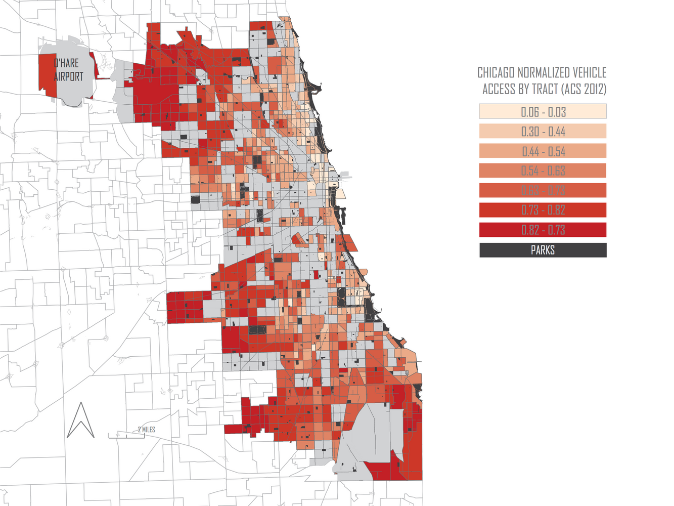
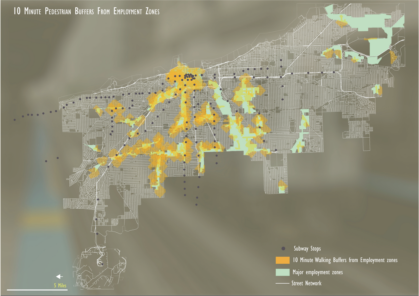
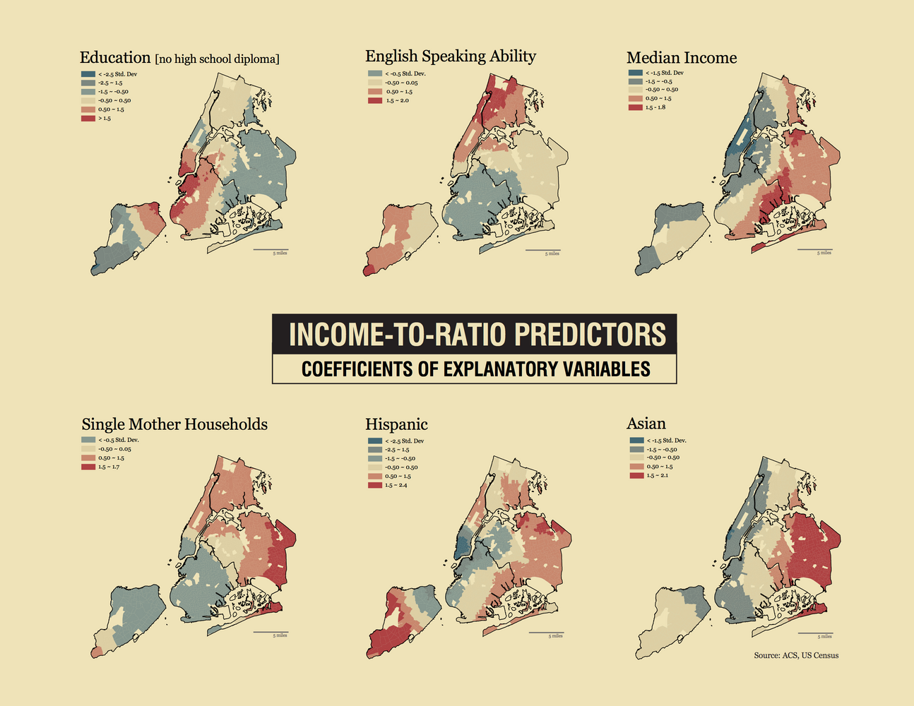
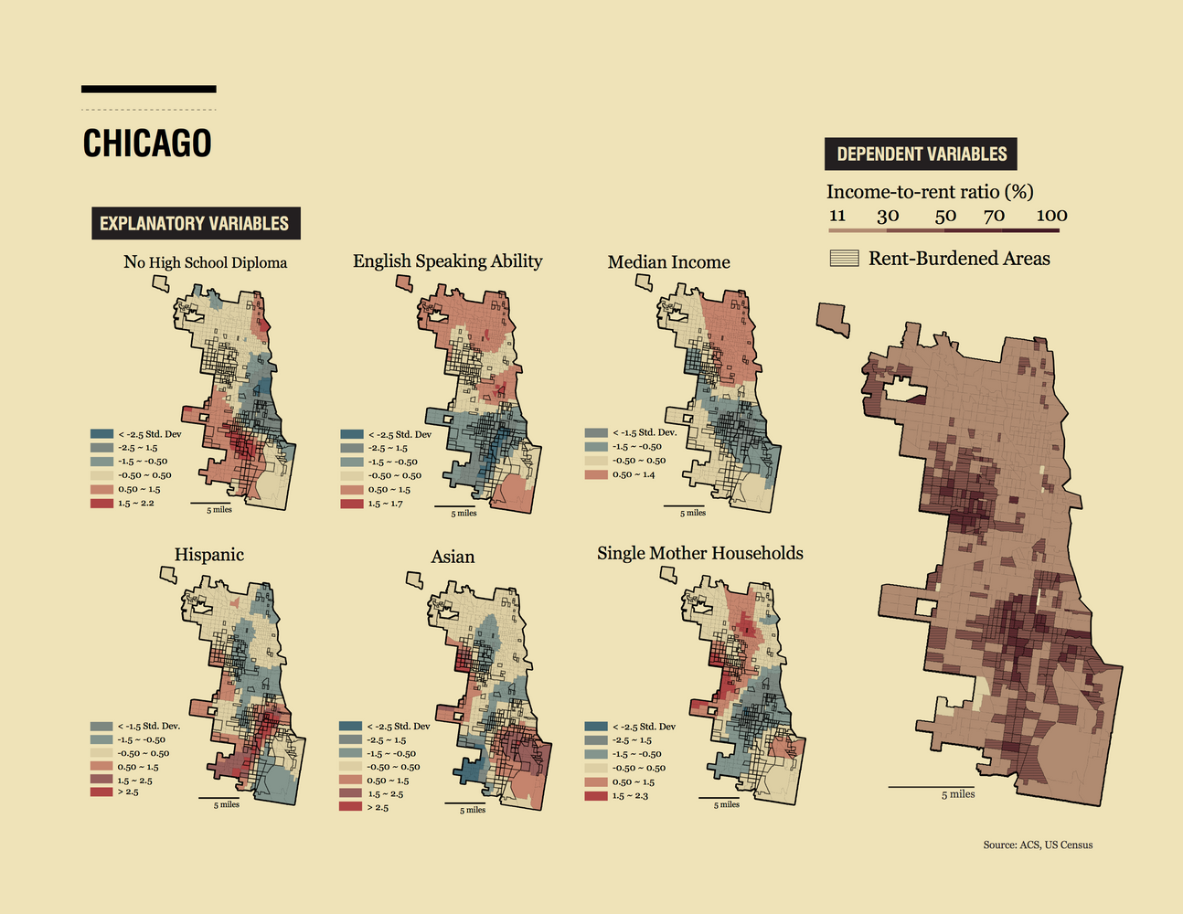
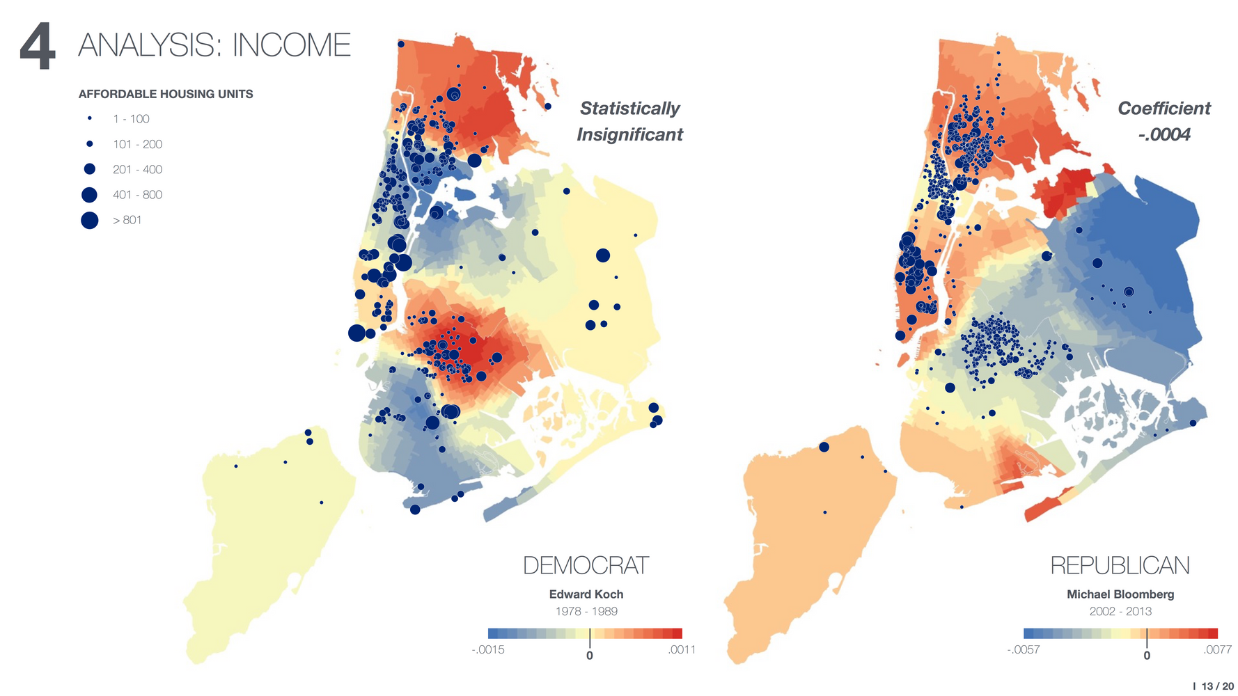
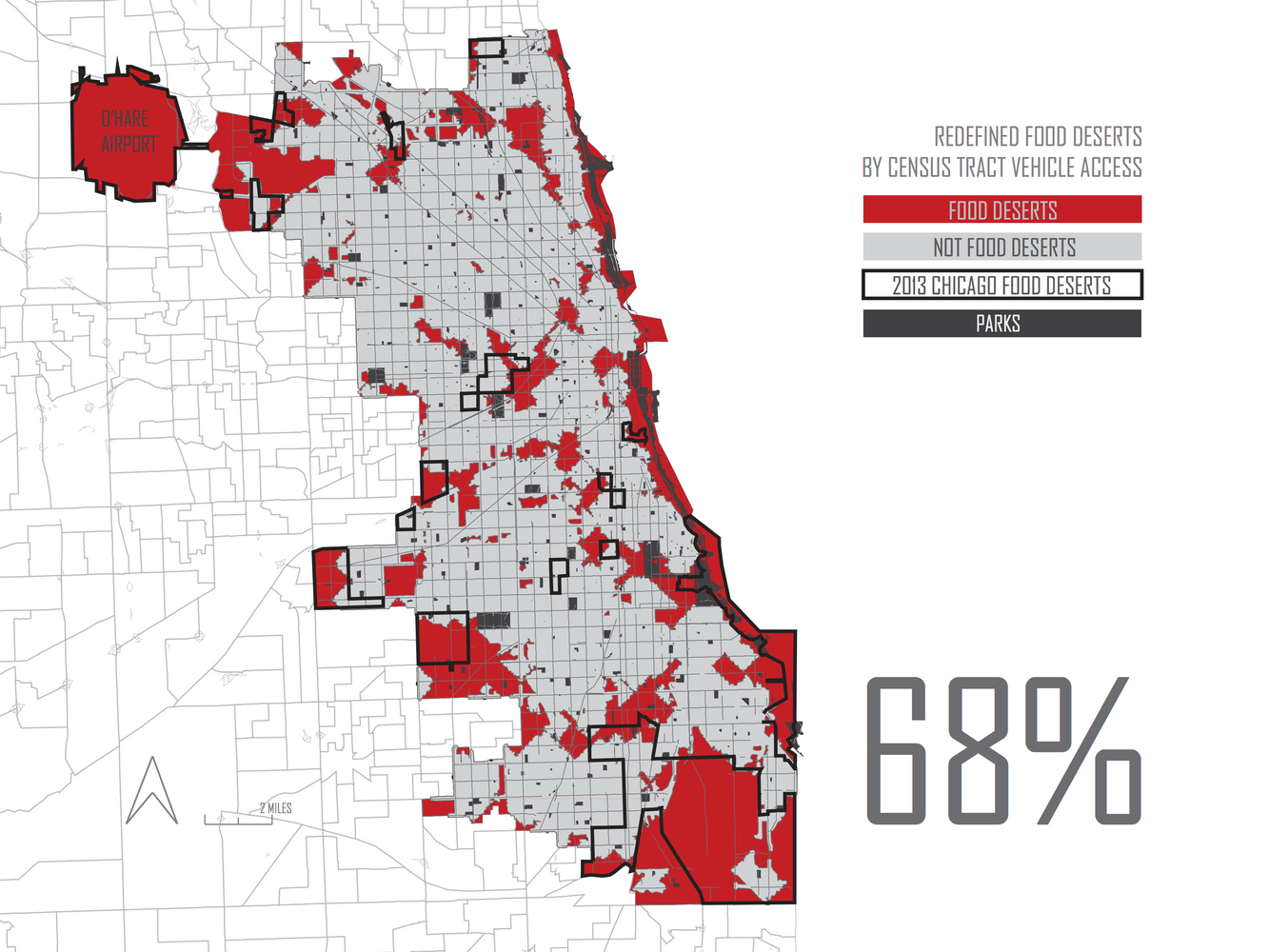
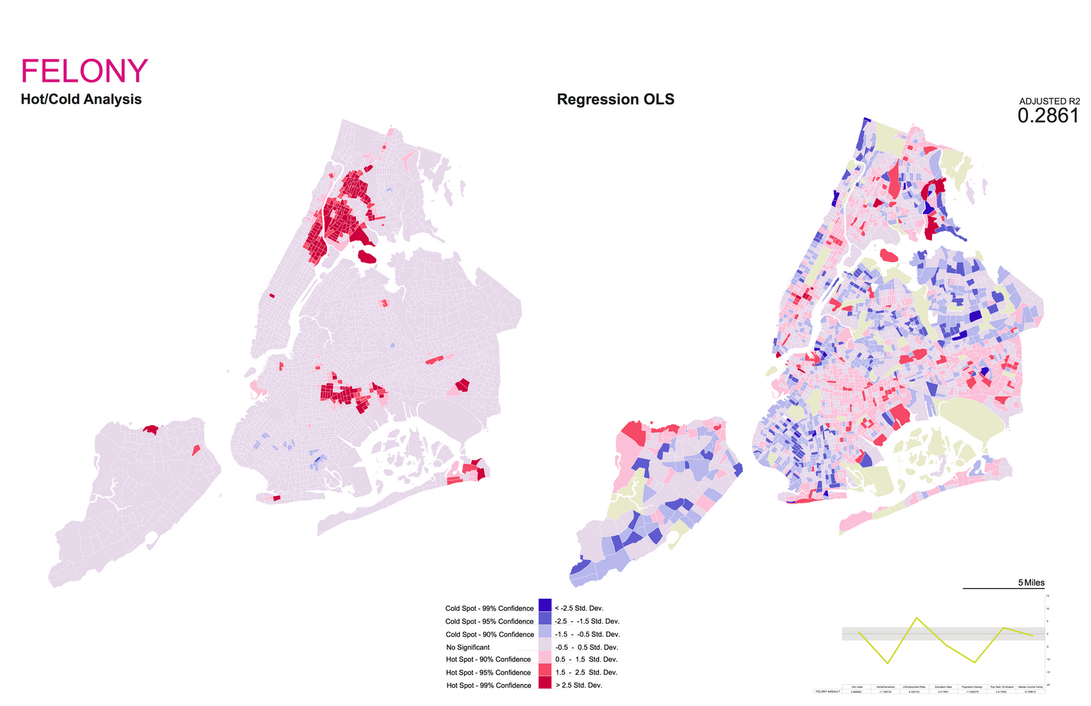
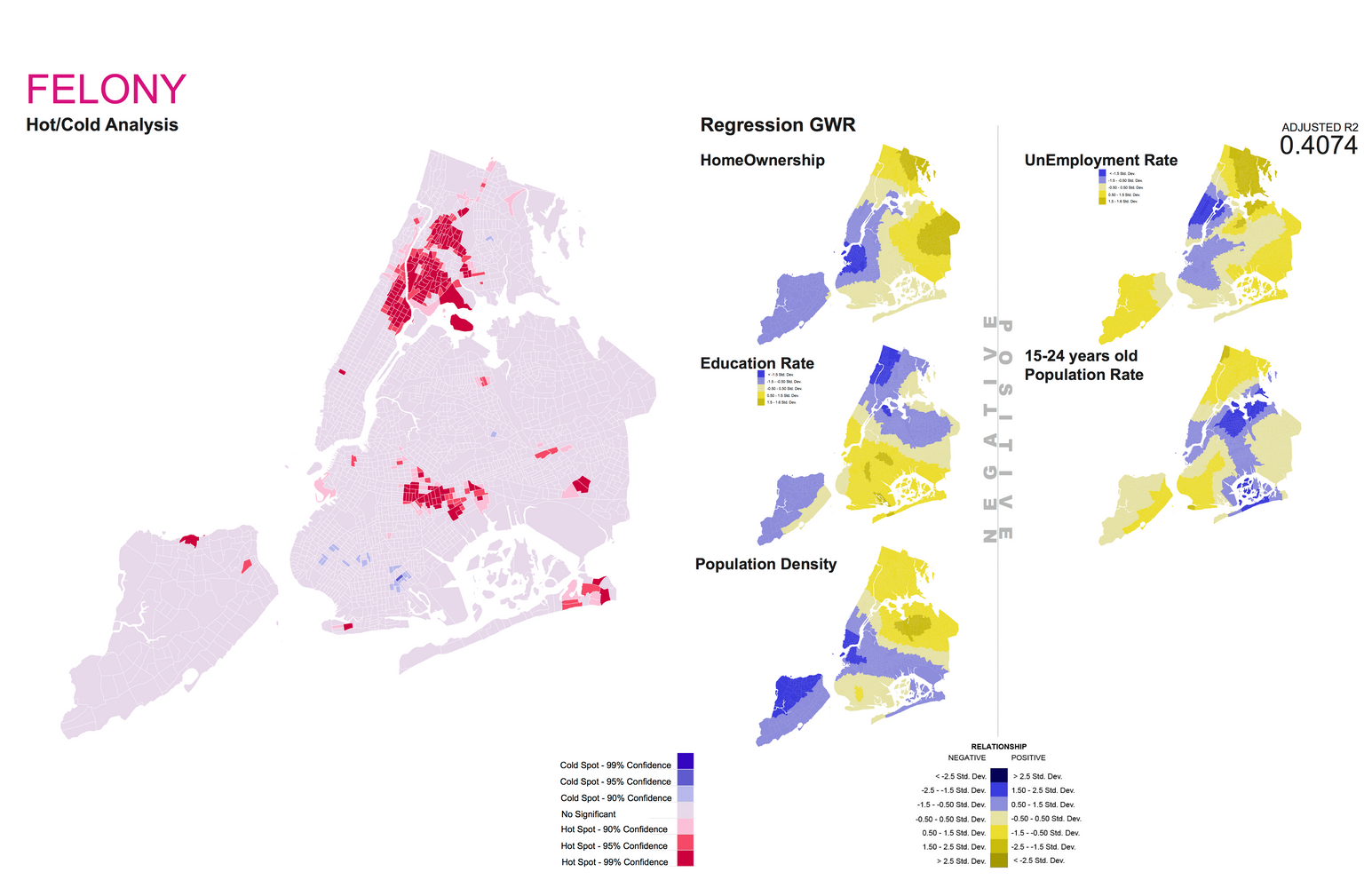
Geographic Information Systems (GIS)
Geographic Information Systems (GIS) have become an essential tool for understanding the environment. It follows that the GIS software has become an invaluable resource for both Architects and Planners in conceptualizing the built environment, and has focused on developing infrastructure and research that explores new possibilities for the uses of GIS.
GSAPP’s GIS infrastructure includes workshops, classes and a collection of GIS data pertaining to the urban environment. This page provides information on how to use GIS, a summary of data on the GIS server, and links to data sources on the web.
GIS Work